Harbour Island Tampa Aerial Photos | From Seddon Island to Waterfront Community
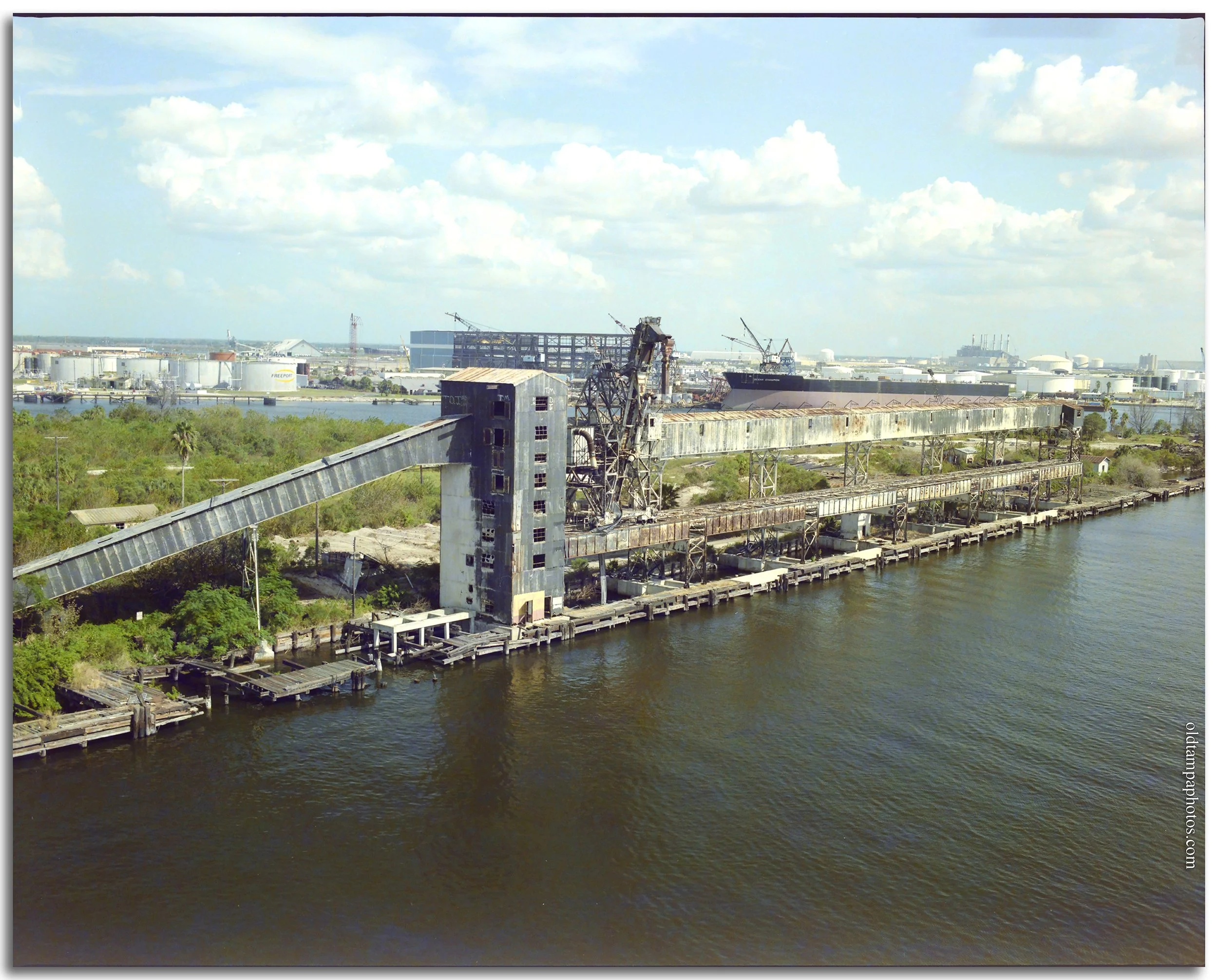
Phosphate elevators looking south on Harbour Island. Circa mid-1980s. Gandy Collection. Courtesy of the University of South Florida Digital Collection
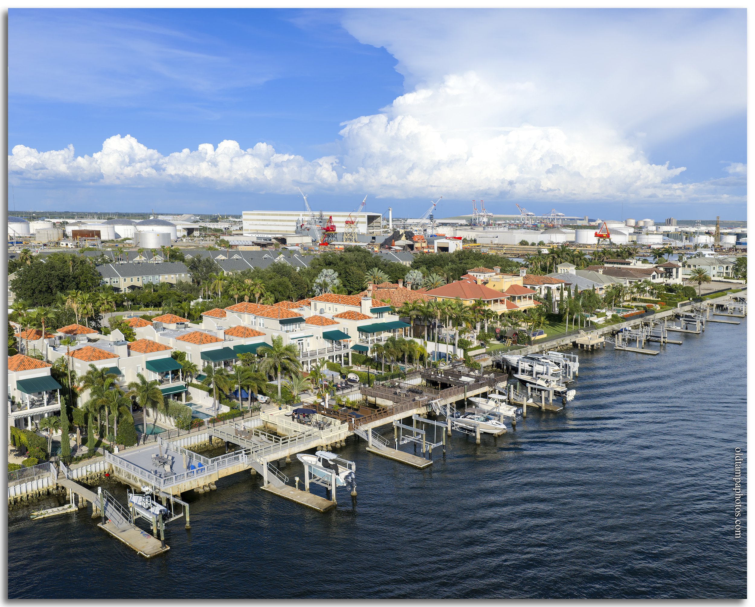
Harbour Island aerial looking south 2026. © Chip Weiner
Harbour Island emerged from the remnants of Seddon Island following the redevelopment of the 177-acre former industrial port and phosphate shipping terminal. In 1971, Beneficial Land Corporation purchased the property from the Seaboard Coast Line Railroad for $3 million, envisioning a master-planned community that could eventually house 14,000 residents. The island was officially renamed Harbor Island in 1979 as that vision began to take shape.
Seddon Island itself was created around 1906 through dredging operations undertaken to expand the Port of Tampa. For decades, it served as one of the region's primary phosphate-export facilities, with ships loading beneath the towering elevators visible in the historic Gandy photographs. The industry brought economic prosperity but also environmental consequences. Residents of nearby Davis Islands recall phosphate dust regularly coating their cars, while pollutants from the loading operations affected surrounding waters. Some longtime residents even describe the water around the island as so phosphorescent that it appeared to glow around fish swimming at night.
In 1959, Tampa merchant Harold Wolf (of Wolf Brothers Department Store), recognizing there were no schools within walking distance for Davis Island's residents, proposed at a meeting of the Davis Islands Civic Association that the city buy Seddon Island, build a bridge from the end of Biscayne Blvd (it was one of the widest) to Seddon Island. Two other bridges to downtown would also be constructed. He proposed a grammar school, a junior and senior high school, a 45,000-seat stadium with parking for 20,000 cars, and hotels be built on the island. It never passed.
Then, a few years before Beneficial's purchase, the site had already attracted attention from civic planners. In 1969, the Tampa Bay Regional Planning Council considered acquiring Seddon Island for a new State Fairgrounds, believing the property could play a major role in revitalizing downtown Tampa.
Beneficial's goal was to transform the grassy industrial landscape—dotted with phosphate-loading equipment, railroad tracks, and shipping docks—into a vibrant waterfront district featuring residential neighborhoods, office buildings, hotels, shops, and restaurants. Planning began soon after the purchase, and the first major phase, consisting of a hotel and shopping plaza, opened in 1985.
The transformation of Seddon Island into Harbour Island became one of Tampa's most ambitious urban redevelopment projects and reflected a broader effort to reclaim the city's industrial waterfront during the late twentieth century. Related projects included the redevelopment surrounding Curtis Hixon Hall following the removal of the railyard in downtown, the construction of the Manger Hotel (now the Sheraton Tampa Riverwalk Hotel), and later the development of the Channel District, including the Tampa Convention Center. Together, these projects helped reshape downtown Tampa from a working industrial port into the mixed-use urban waterfront we see today, fronted by the Tampa Riverwalk.
© Chip Weiner. All rights reserved

Phosphate elevators looking north on Harbour Island. Circa mid-1980s. Gandy Collection. Courtesy of the University of South Florida Digital Collection

Harbour Island aerial looking north 2026. © Chip Weiner
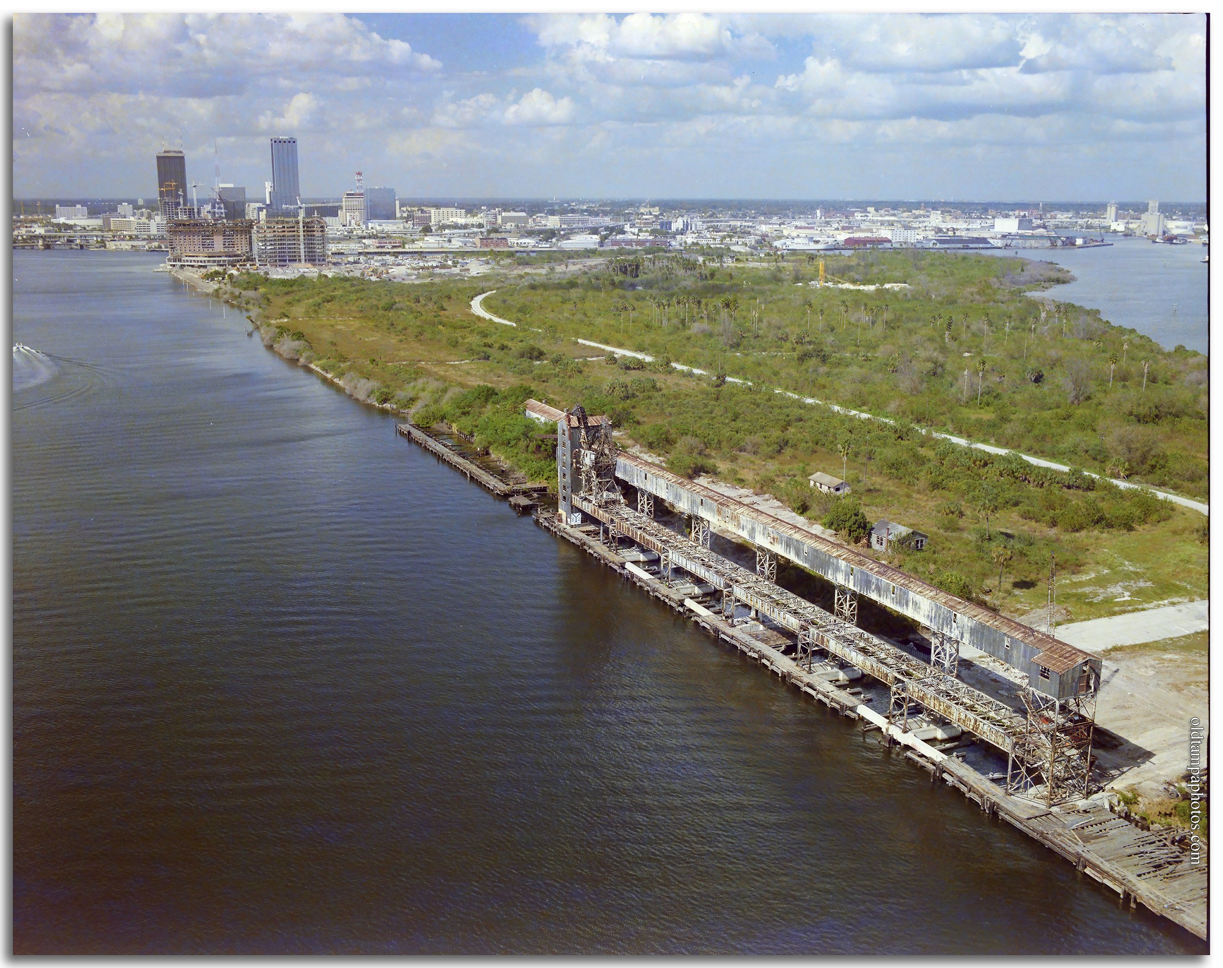
North tip of Harbour Island circa early 1980s. Gandy Collection. Courtesy of the University of South Florida Digital Collection
North tip of Harbour Island with downtown 2026 © Chip Weiner
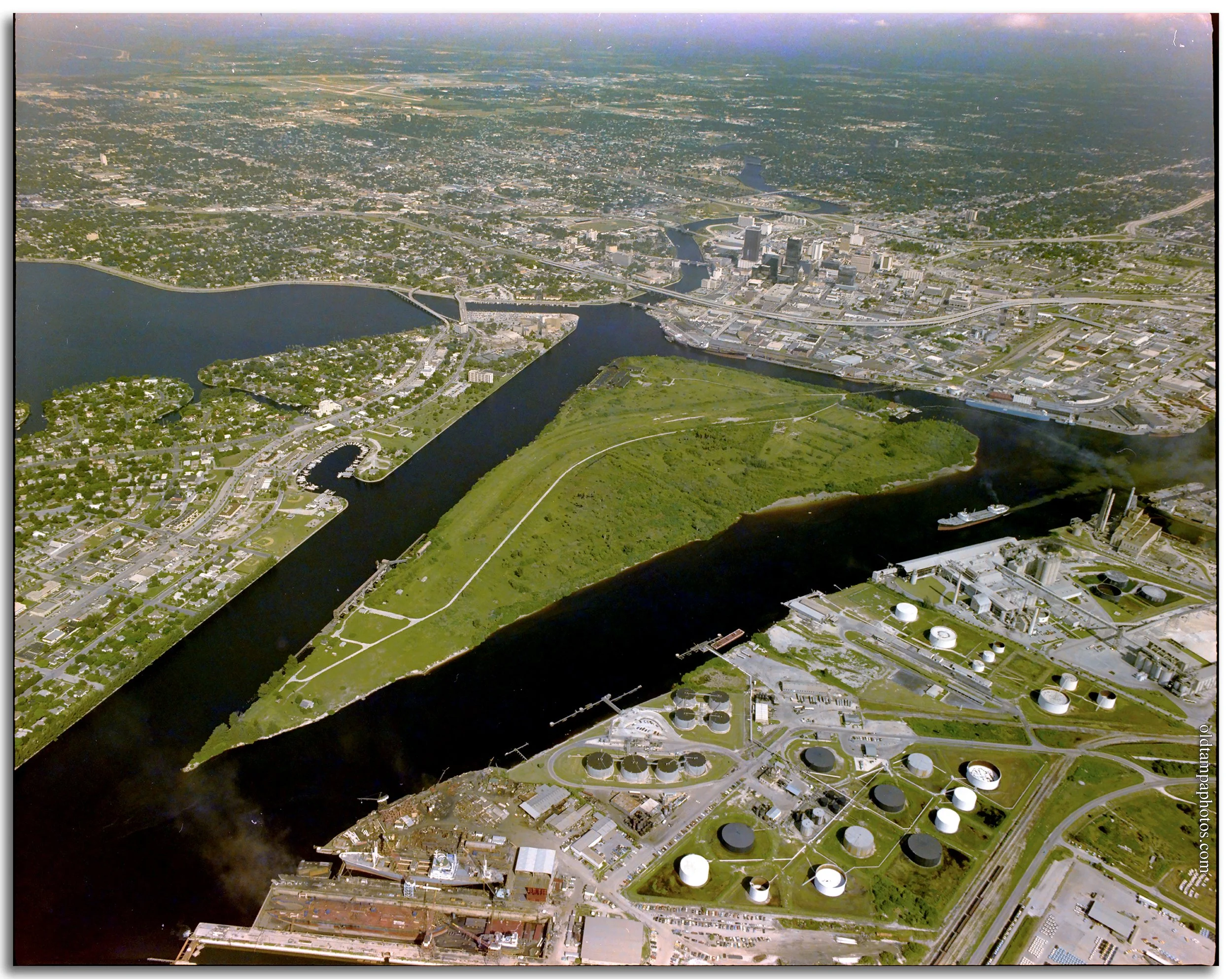
Seddon Island circa late 1970s. Gandy Collection. Courtesy of the University of South Florida Digital Collection
Harbour Island aerial from the south 2026. © Chip Weiner
Harbour Island aerial panoramic from Davis Islands. 2026 © Chip Weiner
Comments:
Commenter Date